Greetings All,
I spent last weekend getting my fresh air and sunshine in a completely different manner, away from recumbent cycling. This week’s topic is backpacking and endurance running. Pardon the length of this post, but there is a lot to tell!
As most of you may know, I have been an amateur radio operator for the past 22 years. One of the joys of ham radio is the opportunity to provide public service through race communications for events such as the Wasatch 100, LOTOJA, and a variety of other public events.
The Wasatch 100 Endurance Race starts in Farmington, Utah on the west side of Francis Peak. For 100 miles the race climbs and descends for 36 hours along the ridgelines and valleys all the way to the Homestead Resort in Midway. The race includes a whopping 27,000 feet of climb! Runners check in at 15 checkpoint/aid stations along the route, where volunteers provide food, drink, blankets, medical attention, and encouragement.
This is where ham radio becomes vital. As each runner arrives at an aid station, their arrival and departure times are recorded by volunteers and entered into a linked digital radio system. The information can then be accessed and tracked from anywhere on the route. This way, in the event of injury no runner’s status is unknown, the race staff has a starting point for search and rescue. In fact, families can access the system on the Internet and view their runner’s progress on Google Earth.
One of the early runners....
What this boils down to is: there are some downright crazy endurance athletes around here! I can’t decide what’s crazier, that a 100-mile run over mountains exists, or that there were 231 entrants willing to go! We met runners of all ages, young, old, male and female. I think the oldest I met was 66 years young.
So, Saturday around noon, I joined my ham radio partner, Brett and his two fine hiking sons, and hiked into Desolation Lake from the Scott’s Pass area. Hiking with Brett is quite an experience. He and his sons are quite knowledgeable about wildlife and what’s good to eat on the trail. They were elated to find delicious fresh currants, ready to eat right off the bush on the trail.
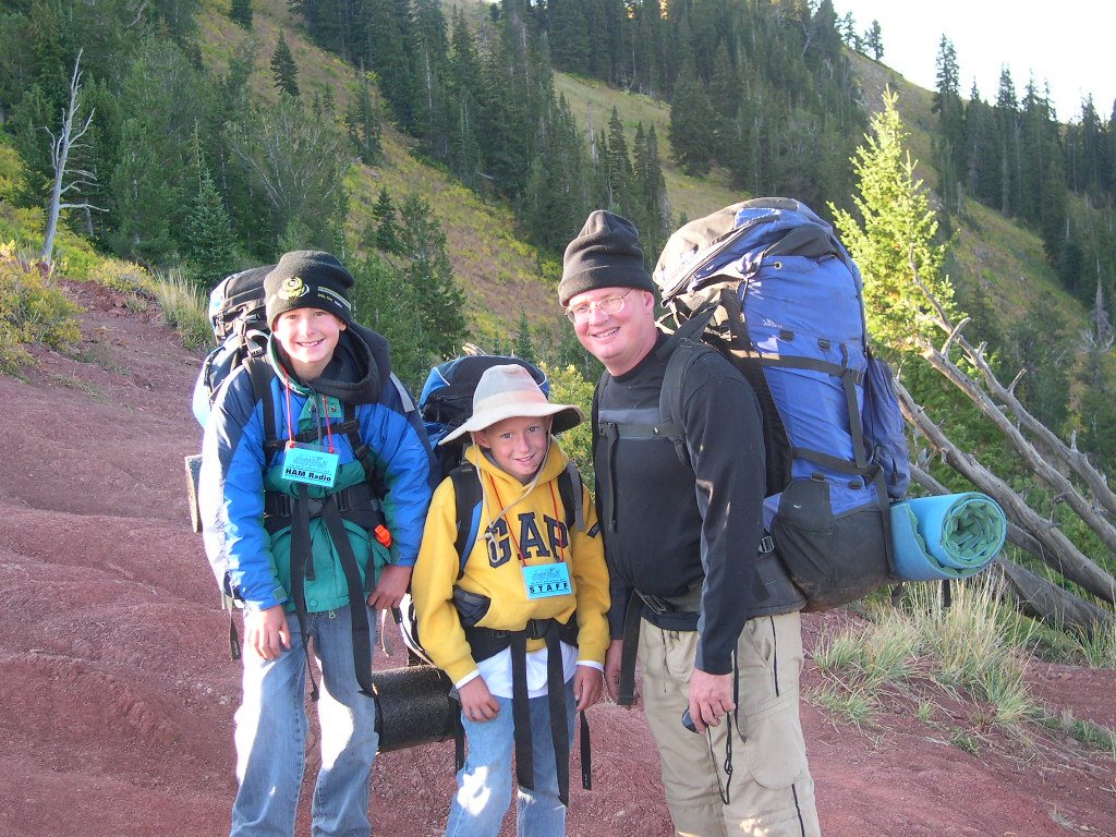
Brett and sons. Fine hikers, all.

Mmmmmmmmm...
I won’t mention the smoked sardines and kippers on the way out on Sunday. This author would have been just as happy with a milkshake and some fries! Backpacking after a brief 30-year absence from the trails was an interesting experience. I found that my cycling legs and all the miles I had ridden had served me well for this 4.5-mile hike. Other than some sore toes, I found that I had strong legs, happy lungs, and could enjoy the hike and the wonderful scenery.
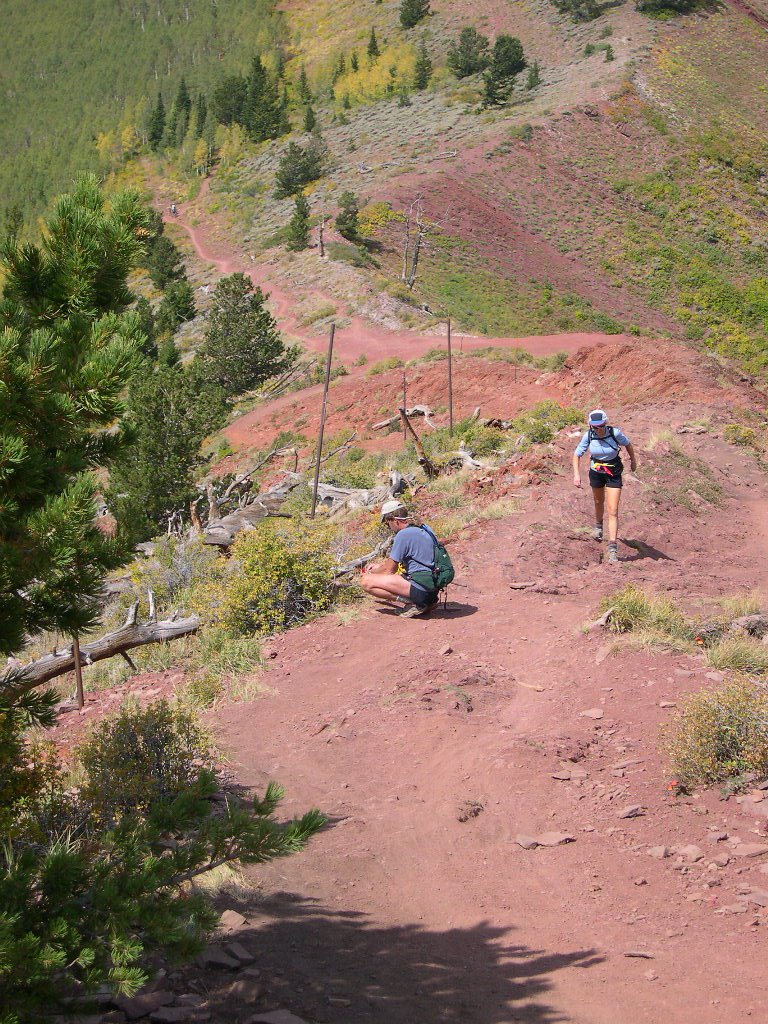
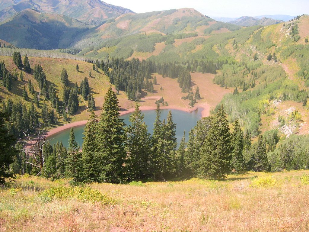
Volunteers mark the trail on Red Lover's Ridge 1,000 ft. above Desolation Lake. The Lake is down to the left, the Park City Ski areas are to the right.
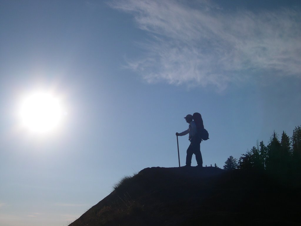
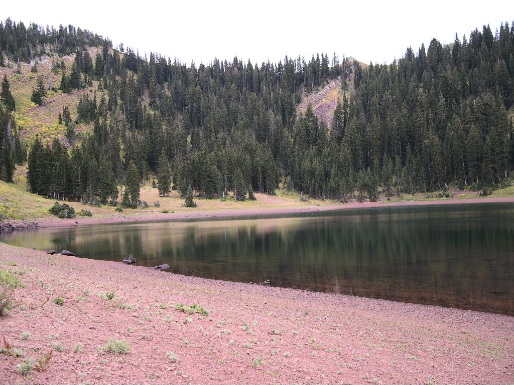
Now, let me introduce you to aid station #9 at Desolation Lake. At approximately 9,200 feet above sea level, it is a picturesque and isolated spot at the 67-mile point of the ‘100. It is the only aid station that cannot be accessed by automobile. The best way to get to the lake is via mountain bike, however since all the stores and supplies had to get there too, the only real method is to backpack in!
Once we arrived at Desolation Lake, we commenced setting up our Vhf station, hanging some antennas in the trees, and making ourselves comfortable. Our operating position was going to be rustic; our equipment perched on some small flat rocks up against the bank of the hill.

Our humble vhf station; one HT for voice, one for packet
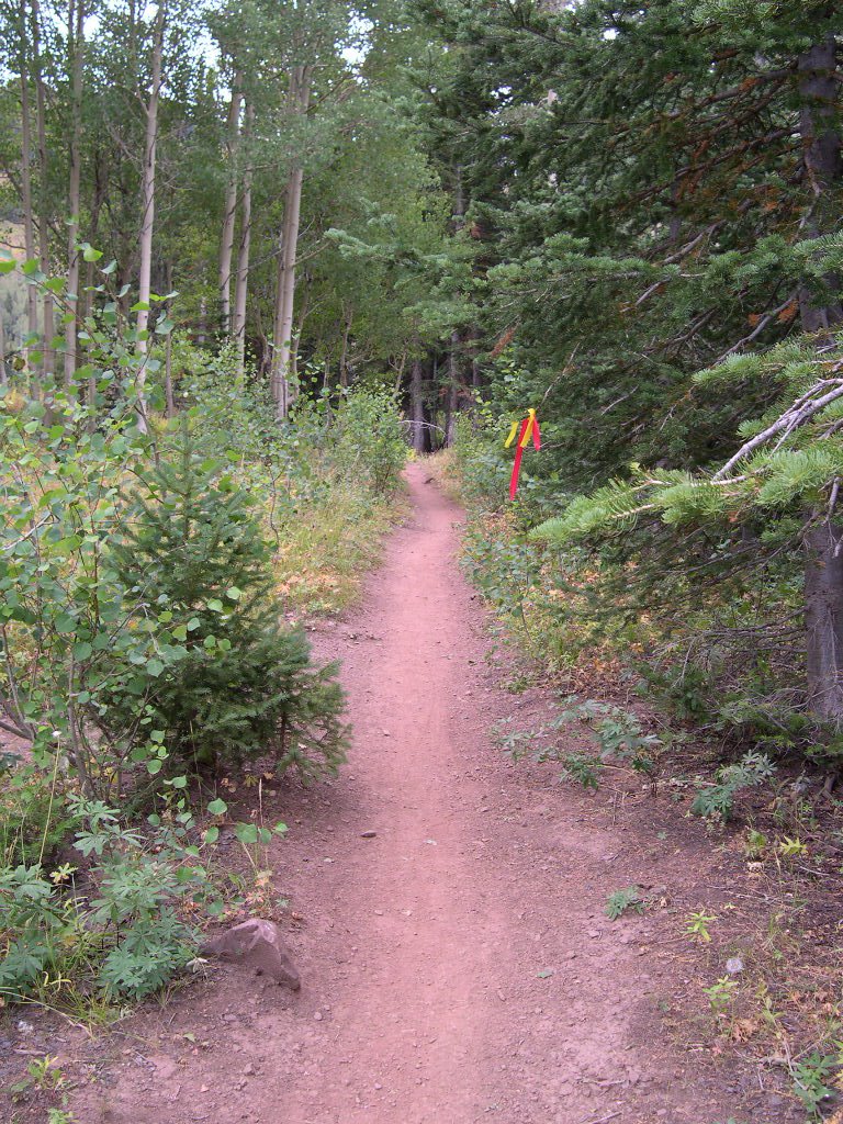
What the runners see on their way; 12 hour glow sticks and fluorescent ribbons
As the afternoon progressed, the aid station team slowly trickled in, hauling backpacks with all the necessary supplies we would need for the long night of runners. A small kitchen was setup, also on a lovely rock table. Truly elegant dining!

"The finest trail kitchen ever built"
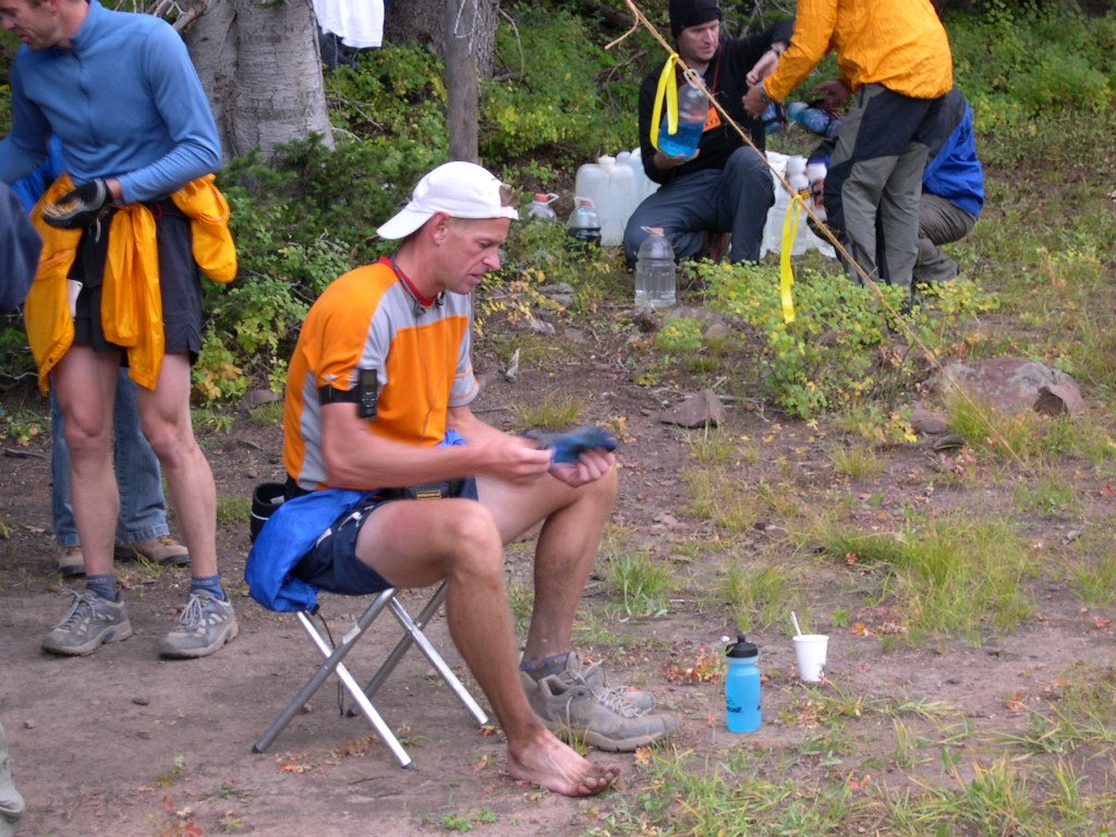
Our first runner, Karl Meltzer, arrived at 6:05 PM, looking healthy, intense, and not even remotely tired after 67 miles of trail running. Of course, he’s won this thing several times, and no one can match him. Thus commenced a long evening of radio check-ins, runner support, more Top Ramen than I have ever seen, and a lot of nice people to hang out with. And as the night progressed into the evil 3-4 A.M. hours, the runners looked worse and worse. Runners that were over-extended, dehydrated, feet full of blisters, the list goes on and on. We fed them, warmed them at our constantly fueled campfire, and encouraged them up the trail. Our last runner left Desolation Lake around 6:30 A.M. hoping to just survive the 8 miles to Brighton before the cutoff time. We learned later that she threw in the towel at Brighton, the same spot where her race ended last year. The weather wasn’t as cold as had been expected, with temps in the high 30’s after midnight. This caused great joy as last year the temperature plunged into the low 20’s! I vividly remember freezing down at Lamb’s Canyon last year.

Sunrise at Desolation Lake; Note the glow stick on the left.
Sunday morning we packed up all the remaining food, struck the campsite, put out the fire, bid each other farewell, and we all headed down the trail The main volunteer team hiked west, down “Mill D”, and we hiked east back up the hill to the ridge to Scott’s Pass. The hike out was gorgeous, full of lovely scenery, utter silence and peace and solitude. It was one of the more enjoyable hikes I have had in a long time.

Our checkpoint was right near the shadow line, near the fork in the trail. The runners came up the steep canyon in the upper center of the photograph, then would leave Desolation to hike to this position way up Red Lover's Ridge.
It was a great weekend. Having been served by aid station volunteers just two weeks ago on the Cache Valley Century, it was great to be on the other side of the fence, returning the favor. Now, I can refocus my riding to the exploration of some our beautiful canyons. A cool weather system has arrived, putting an end to the summer heat, so hill climbing will be more tolerable, and the fall colors resplendent!
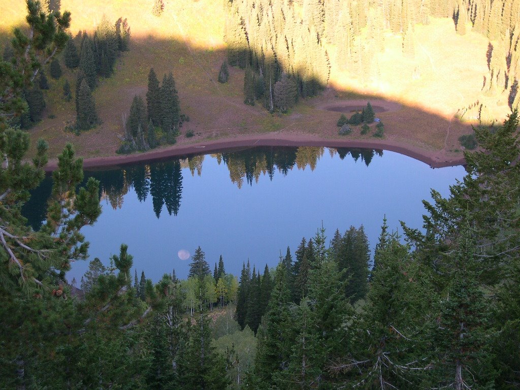
The moon reflected at Desolation, Can you find the tent in the picture?
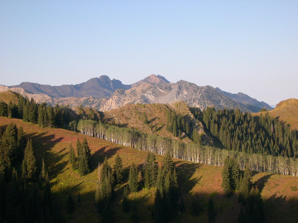
The Salt Lake Twins, and Dromedary Peak (Can you guess which one is Dromedary?)

Looking southwest, towards the Solitude Ski Area
Please enjoy the pictures from the hike. Perhaps they will give you something to dream about during the cold winter months.
And finally, Karl did win the whole thing; 100 miles, 27,000 feet of climbing, in 20 hours, 14 minutes. He beat the second place finisher by an amazing 1 hour and 40 minutes!
See you all down the road…
jim
4 comments:
i really loved those pictures mr. rud, wish i could be there
Jon:
Step 1:Put on Boots
Step 2: Take nice girl friend in car up Big Cottonwood Canyon
Step 3: Stop at any of the dozen or so trailheads on the way up the hill.
Step 3, taking snacks and water, go have a nice hike!
Mr R
Me too, but what's wrong with panniers on a mountain bike?
Or a BOB trailer.
The newer photos are very good.
Poit
Pete,
One of the crew came down from Red Lover's Ridge on a MTB with about a 50 pound pack on his shoulders! I asked him how his descent was, and he replied: "Well, the rims didn't fail!"
It's the one picture I missed!
Panniers would have worked well. I am going to MTB in next year. A BOB? hmmm not thinking the trail would accomodate that!
Post a Comment