Tuesday, September 26, 2006

Moisey-ing Around


Greetings All,
This past week we have been blessed with lovely fall weather. Cool mornings, and mild afternoons, along with crystal clear blue skies have seriously tempted anyone who works indoors to escape outdoors. So, what's a cyclist to do? Go for a ride!

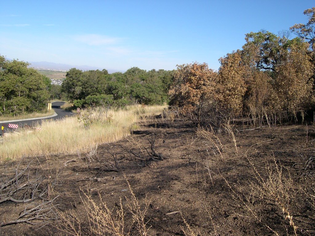
This past Monday, I finally summed up my courage to go climb a big hill I have been avoiding, and drove out Highway 84 to Peterson to the foot of the Trapper's Loop road. (Cycling on Highway 84 in Weber Canyon is narrow and dangerous, hence the car.) Trapper’s Loop is a 12-mile drive that connects the small towns of Peterson and Huntsville. This steep climb rises 6 miles and about 2,000 feet to the entrance to Snowbasin Ski Resort, before going down the hill to the Huntsville area. As a point of trivia, Snowbasin was the location of the Super G and Downhill events at the 2002 Winter Olympics. I have never climbed this hill before, so it would be interesting to see how all my miles and conditioning would fare.


This is the best Google Earth can come up with! Peterson is at the bottom and the Snowbasin turnoff is near the top of this image.

Climbing steep hills on a recumbent bike requires different techniques than riding an upright bike. An upright rider can stand up on the pedals, and push down with shoulders, hips, and use a lot of leverage while working hard uphill.
Recumbent riders however can only rely on their legs! Spinning technique is also paramount to effective climbing. One must spin smoothly through the whole pedal stroke making sure that you pull through the bottom of the circle. Now, you should know that my spinning technique is still a work in progress. Both my cadence and strength in pulling at the bottom of the pedal stroke are things that I have been working on through the season. And as a friend of mine at work once told me: “The only way to learn how to spin while climbing is to go climb!”


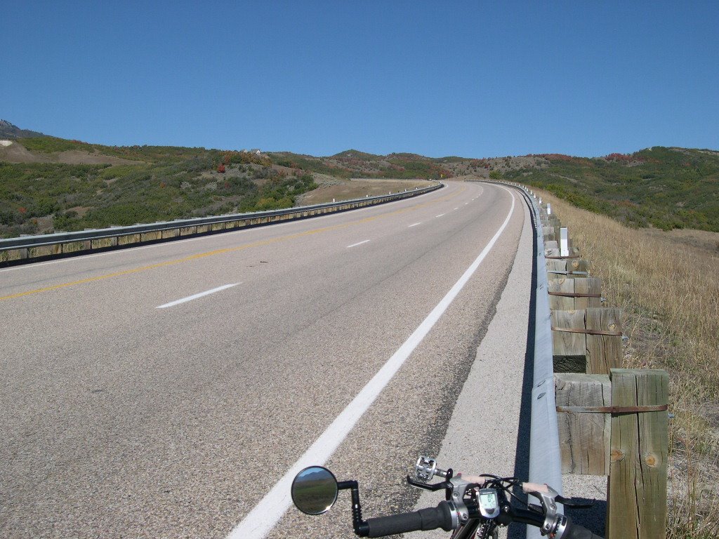
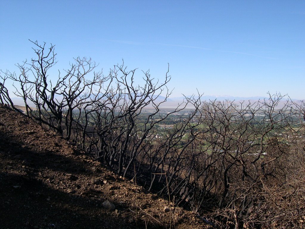
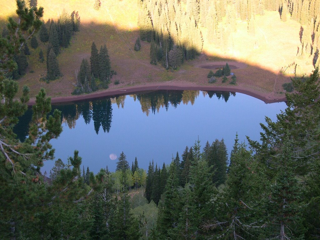
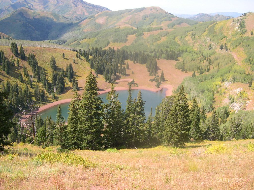
Climbing to the sky...

So, after a nice 4 mile warm up loop on the frontage road east of Peterson, I started my spin up Trapper’s. Spinning at about 70 rpm, in the granny gear, and the middle of the rear set netted a speed of about 6-8 mph, and 12 mph near the top as the terrain leveled out slightly . It was a lovely ride! I took my time, riding at a consistent pace, stopping occasionally to take a few pictures. I made it almost to the top, turning around at milepost 5 about ¾ of a mile from Snowbasin. I had to head back to the car as my time had expired. I had to work later that day, and had run out of time. As beautiful as the day was, it pained me to think about having to go to work.


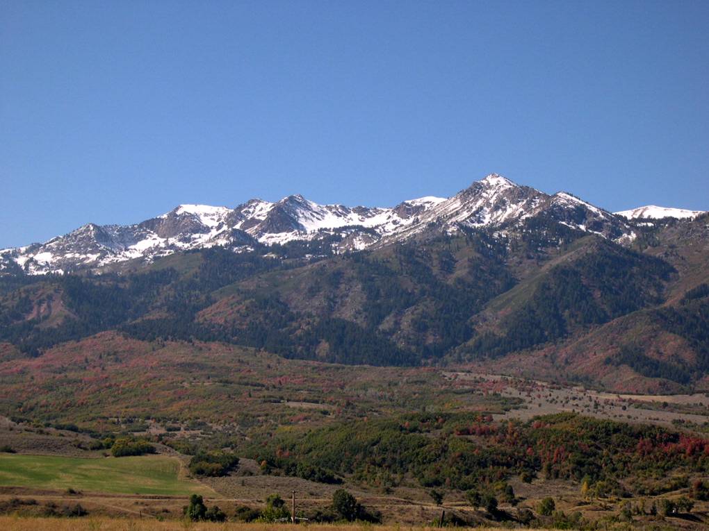
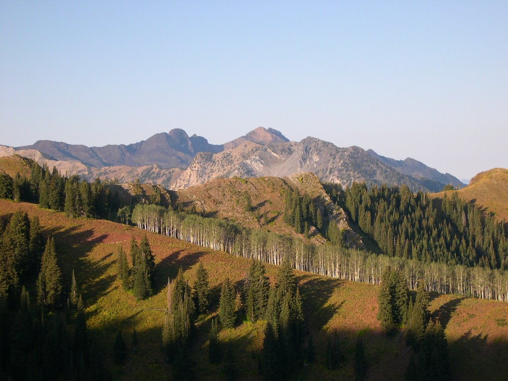
DeMoisey Peak, Elevation 10,716 Ft. The top of Snowbasin

Going downhill. Did I mention that the payoff for several miles of steep climbing is the warp speed descent? Yahoo! Boy, this part was fun! I enjoyed speeds between 38-42 mph, riding the brakes from time to time to make sure I had control of the bike. Keeping with my promise of being safe on this hill, I kept the descent fairly conservative. There are some shifting winds in the more curved sections and I was unfamiliar with this descent. I think if I had ramped up my pedaling, and really stepped on the gas, that 50-55 mph would not have been out the realm of imagination. But even riding conservatively the descent was just a rush; zipping down the hill effortlessly, letting the bike just run was very enjoyable.


Ok, everyone make a Homer Simpson sound: Mmmmmmmmm downhill!!!!

All in all, it was a great morning of riding. I imagine I will return and ride the ‘Loop again this fall. What’s the next canyon ride? More than likely it will be Mill Creek Canyon just east of Salt Lake City. With lots of shade and fall colors, it should be a lovely ride.

Until next week,

Jim

Tuesday, September 19, 2006

"Never in the course of human events.....


... has so much damage been done by well meaning folks who thought they were doing the right thing!"

This timeless quote from my Dad, Austin, is the perfect title for this midweek entry. Last Thursday, on a windy and hot afternoon, a woman who lives near the Fernwood Park (See the June 17th post) noticed a large amount of loose brush and sticks close to her house and was worried that they could become a fire hazard during this dry season. So, what do you think she did?

She burned them!

Brilliant. Sheer genius.


The view from my roof!

Of course the wind joined in, and inside of 90 minutes 400 acres of scrub oak and trees were aflame. A magnificent fire, which quickly jumped 3 ridgelines and was showing potential to become a very large disaster. But, all good things come to an end, and this fire ended quickly.

Why? RAIN, and lots of it. As I was up on the roof taking pictures of this fire which could be easily seen from my house, I heard the thunder of an approaching storm. And shortly after that, it began to thunder and rain heavily. Talk about divine intervention! Between the rain and the air tanker drops, the fire crews made quick work of the remaining hot spots, and a second large thunderstorm an hour later finished the job. Amazingly, no houses or personal property were damaged!

I suppose this would be a good spot in this entry for an editorial or scathing rant about fire saftey, or how stupid some people can be. But, I think I will leave that to someone else, as enough has already been said in the paper and in the news broadcasts. I will just miss the fall colors that have been burned away!

Yesterday, (9/18), I rode my Barcroft up to Fernwood to see how close the fire came to the campground. I enjoyed a nice walk up the Bonneville Shoreline Trail to take some pictures from some of the burned area.


Almost to the park, but not quite!


It really was sad to see the destruction, although it could have so much worse had the rain and hail not come at such an opportune moment. Now, to watch for the next full season to see how the growth reappears next spring. I'll keep you posted!

Jim

Thursday, September 14, 2006

Welcome to Desolation Lake!


Greetings All,
I spent last weekend getting my fresh air and sunshine in a completely different manner, away from recumbent cycling. This week’s topic is backpacking and endurance running. Pardon the length of this post, but there is a lot to tell!

As most of you may know, I have been an amateur radio operator for the past 22 years. One of the joys of ham radio is the opportunity to provide public service through race communications for events such as the Wasatch 100, LOTOJA, and a variety of other public events.

The Wasatch 100 Endurance Race starts in Farmington, Utah on the west side of Francis Peak. For 100 miles the race climbs and descends for 36 hours along the ridgelines and valleys all the way to the Homestead Resort in Midway. The race includes a whopping 27,000 feet of climb! Runners check in at 15 checkpoint/aid stations along the route, where volunteers provide food, drink, blankets, medical attention, and encouragement.

This is where ham radio becomes vital. As each runner arrives at an aid station, their arrival and departure times are recorded by volunteers and entered into a linked digital radio system. The information can then be accessed and tracked from anywhere on the route. This way, in the event of injury no runner’s status is unknown, the race staff has a starting point for search and rescue. In fact, families can access the system on the Internet and view their runner’s progress on Google Earth.


One of the early runners....

What this boils down to is: there are some downright crazy endurance athletes around here! I can’t decide what’s crazier, that a 100-mile run over mountains exists, or that there were 231 entrants willing to go! We met runners of all ages, young, old, male and female. I think the oldest I met was 66 years young.

So, Saturday around noon, I joined my ham radio partner, Brett and his two fine hiking sons, and hiked into Desolation Lake from the Scott’s Pass area. Hiking with Brett is quite an experience. He and his sons are quite knowledgeable about wildlife and what’s good to eat on the trail. They were elated to find delicious fresh currants, ready to eat right off the bush on the trail.


Brett and sons. Fine hikers, all.


Mmmmmmmmm...

I won’t mention the smoked sardines and kippers on the way out on Sunday. This author would have been just as happy with a milkshake and some fries! Backpacking after a brief 30-year absence from the trails was an interesting experience. I found that my cycling legs and all the miles I had ridden had served me well for this 4.5-mile hike. Other than some sore toes, I found that I had strong legs, happy lungs, and could enjoy the hike and the wonderful scenery.


Volunteers mark the trail on Red Lover's Ridge 1,000 ft. above Desolation Lake. The Lake is down to the left, the Park City Ski areas are to the right.

Now, let me introduce you to aid station #9 at Desolation Lake. At approximately 9,200 feet above sea level, it is a picturesque and isolated spot at the 67-mile point of the ‘100. It is the only aid station that cannot be accessed by automobile. The best way to get to the lake is via mountain bike, however since all the stores and supplies had to get there too, the only real method is to backpack in!


Once we arrived at Desolation Lake, we commenced setting up our Vhf station, hanging some antennas in the trees, and making ourselves comfortable. Our operating position was going to be rustic; our equipment perched on some small flat rocks up against the bank of the hill.


Our humble vhf station; one HT for voice, one for packet


What the runners see on their way; 12 hour glow sticks and fluorescent ribbons

As the afternoon progressed, the aid station team slowly trickled in, hauling backpacks with all the necessary supplies we would need for the long night of runners. A small kitchen was setup, also on a lovely rock table. Truly elegant dining!


"The finest trail kitchen ever built"

Our first runner, Karl Meltzer, arrived at 6:05 PM, looking healthy, intense, and not even remotely tired after 67 miles of trail running. Of course, he’s won this thing several times, and no one can match him. Thus commenced a long evening of radio check-ins, runner support, more Top Ramen than I have ever seen, and a lot of nice people to hang out with. And as the night progressed into the evil 3-4 A.M. hours, the runners looked worse and worse. Runners that were over-extended, dehydrated, feet full of blisters, the list goes on and on. We fed them, warmed them at our constantly fueled campfire, and encouraged them up the trail. Our last runner left Desolation Lake around 6:30 A.M. hoping to just survive the 8 miles to Brighton before the cutoff time. We learned later that she threw in the towel at Brighton, the same spot where her race ended last year. The weather wasn’t as cold as had been expected, with temps in the high 30’s after midnight. This caused great joy as last year the temperature plunged into the low 20’s! I vividly remember freezing down at Lamb’s Canyon last year.


Sunrise at Desolation Lake; Note the glow stick on the left.

Sunday morning we packed up all the remaining food, struck the campsite, put out the fire, bid each other farewell, and we all headed down the trail The main volunteer team hiked west, down “Mill D”, and we hiked east back up the hill to the ridge to Scott’s Pass. The hike out was gorgeous, full of lovely scenery, utter silence and peace and solitude. It was one of the more enjoyable hikes I have had in a long time.


Our checkpoint was right near the shadow line, near the fork in the trail. The runners came up the steep canyon in the upper center of the photograph, then would leave Desolation to hike to this position way up Red Lover's Ridge.

It was a great weekend. Having been served by aid station volunteers just two weeks ago on the Cache Valley Century, it was great to be on the other side of the fence, returning the favor. Now, I can refocus my riding to the exploration of some our beautiful canyons. A cool weather system has arrived, putting an end to the summer heat, so hill climbing will be more tolerable, and the fall colors resplendent!


The moon reflected at Desolation, Can you find the tent in the picture?


The Salt Lake Twins, and Dromedary Peak (Can you guess which one is Dromedary?)


Looking southwest, towards the Solitude Ski Area

Please enjoy the pictures from the hike. Perhaps they will give you something to dream about during the cold winter months.

And finally, Karl did win the whole thing; 100 miles, 27,000 feet of climbing, in 20 hours, 14 minutes. He beat the second place finisher by an amazing 1 hour and 40 minutes!

See you all down the road…
jim

Tuesday, September 05, 2006

Not all Arches are Golden

Greetings all,
Oh, it is so nice to be home! I spent the last week away at an FAA conference in St. Louis. Being trapped in a huge conference room with 1,000 people from 8:00 AM till 6:00 PM will make one yearn for fresh air, the open road and one’s bike. It was quite a change from the high miles and century riding in August.
One of the good points to the trip was that our hotel was a stone’s throw from the Jefferson National Expansion Memorial. That is the actual name of the Gateway Arch in St. Louis. Quoting from the National Park Service Website; “Thomas Jefferson’s vision of the spread of freedom and democracy from “sea to shining sea” inspired Eero Saarinen’s masterpiece of modern design. The 630 foot stainless steel Gateway Arch reflects St. Louis’ role as the gateway to the West.” http://www.nps.gov/archive/jeff/arch-ov.htm
This magnificent structure is really amazing to look at and explore. Built in 1965 and dedicated in 1968, the Arch is constructed in the shape of a catenary curve, 630 ft. high and 630 ft. wide. It was constructed with an outer layer of stainless steel, and an inner layer of carbon steel and concrete. And once I walked up to the base and looked up, I truly saw what an amazing structure it really is.
So, back to why this is here on my blog. My only escape from the meetings was to head out at every opportunity to walk, stretch my legs and take pictures! I also went out in the evenings after dinner to try my hand at long exposure night photography of the Arch.
So, since I had no opportunity to ride, here are a few of my favorites from St. Louis.
Enjoy!

More news and riding as the month gets going...


The Arch sometimes has an ethereal look to it...


I had to lay on the ground to get this picture. I used my little tripod, and about a one second exposure.


The Busch Stadium lights do a fine job of lighting the Arch.


I noticed some very interesting optical illusions that defy the fact that the Arch is straight and symetrical.


But, it is!